Impact of Fall Cold Front on Tropical Activity in the Atlantic
A strong fall cold front is projected to keep tropical systems away from the U.S. for now, with a Tropical Disturbance near Africa possibly developing into a tropical depression. An upper-level disturbance may reinforce this cold front, preventing tropical activity through at least next week. The situation is under observation, particularly regarding potential impacts on Central America from any developing systems.
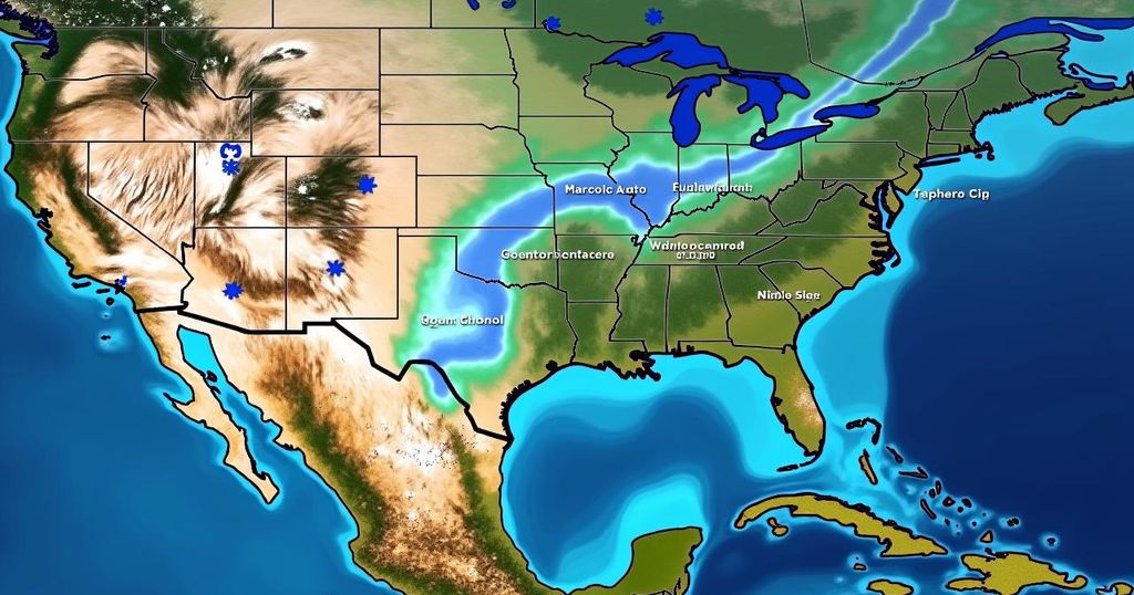
Bryan Norcross has reported that a formidable fall cold front will effectively deter any potential tropical systems from approaching the United States for the immediate future. Presently, a Tropical Disturbance is seen moving westward near Africa, with the National Hurricane Center estimating a moderate probability of it evolving into a tropical depression within the next few days. Forecasts indicate that an upper-level disturbance residing over Alaska is expected to enhance a dip in the jet stream across the eastern United States, thereby propelling a cold front through Florida next week. The combined effects of the surface cold front and the upper-level jet stream will hinder tropical systems from encroaching upon the northern Gulf or the Atlantic for at least the upcoming week. In the Atlantic region, the aforementioned Tropical Disturbance continues to progress westward, and while it may reach the vicinity of the Caribbean islands by the end of next week, vigilance will be necessary to monitor its development. Currently, Tropical Storm Leslie is dissipating and is not anticipated to make landfall. Additionally, the American GFS computer model forecasts the potential for a vigorous storm forming in the southwestern Caribbean Sea later in the week. However, alternative computer models predict minimal activity, suggesting any developing system would likely impact Central America. Notably, disturbances are prone to materializing in the southern Caribbean during this time of year, and the strong east-to-west winds associated with the cold front may serve to catalyze such developments. This region remains under close observation as the hurricane season progresses. Fortunately, for the millions residing in Central and Western Florida who are still without power, the onset of autumn weather heralds the arrival of cooler, drier air.
The article discusses the impact of a strong fall cold front on tropical systems in the Atlantic. It outlines how this cold front, coupled with an upper-level disturbance over Alaska, will inhibit the formation and progression of any tropical systems toward the United States, particularly affecting regions like Florida and the Gulf of Mexico. The National Hurricane Center has categorized a Tropical Disturbance near Africa as having a medium likelihood of developing into a tropical depression, and the article provides updates on the potential movement and development of various tropical systems in the coming weeks. It also highlights the weather conditions in Florida, specifically the transition to cooler temperatures which will be beneficial for residents affected by power outages.
In conclusion, the significant cold front is expected to maintain stability in the weather patterns over the eastern United States, shielding the region from potential tropical developments for the immediate future. As various disturbances are monitored, particularly the movement of systems from the Caribbean, the potential impacts on Central America and surrounding areas warrant attention. The arrival of fall weather provides a much-needed respite for those recovering from recent disruptions. This information serves as a reminder of the dynamic nature of climatic systems and the importance of staying informed through authoritative weather updates, particularly during hurricane season.
Original Source: www.foxweather.com


Post Comment