Fading Prospects for October Named Storms in the Atlantic
The article discusses the decreasing likelihood of tropical disturbances in the Atlantic developing into named storms, with Hurricane Milton predicted as potentially the last of October. Two disturbances are currently monitored, including Invest 94L, facing significant challenges for development. Meanwhile, the North Indian Ocean prepares for its cyclone season, with expectations for activity to increase due to favorable atmospheric conditions.
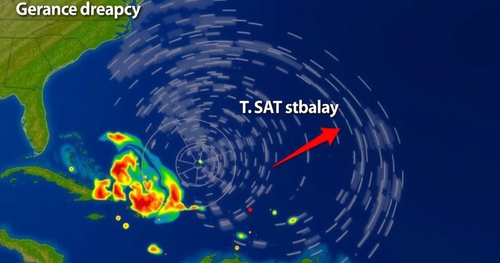
After an active start to October in the tropical Atlantic, activity has subsided, with attention now on two disturbances that show minimal potential for developing into named storms. Current forecasts suggest that Hurricane Milton may be the last named storm of October. However, with the anticipated arrival of a Madden-Julian Oscillation (MJO) pulse in early November that promotes uplifting air and increases the chances of tropical cyclone formation, it remains premature to declare the conclusion of the Atlantic hurricane season of 2024. The first disturbance, referred to as Invest 94L, is located near the Leeward Islands and moving westward at approximately 20 mph. Despite favorable conditions, such as low wind shear and exceptionally warm ocean temperatures of 30 degrees Celsius (86°F), the system is experiencing limitations due to a very dry air mass which restricts significant thunderstorm activity. Its rapid movement further hampers organizational development, complicating the alignment of the surface and upper-level components necessary for strengthening. Additional hindrances include unfavorable MJO configurations that favor descending air over the Atlantic. Forecast models predict significant obstacles for 94L’s development over the weekend: strong wind shear if it continues west-northwest towards Florida, or the mountainous terrain of Hispaniola if it shifts west-southwestwards. Current assessments suggest considerable skepticism regarding 94L’s ability to strengthen, forecasting its dissipation by Sunday while potentially producing heavy rainfall of 1 to 2 inches (25-50 mm) across the Leeward Islands, Virgin Islands, Puerto Rico, and the Dominican Republic from Friday through Saturday. The National Hurricane Center has assigned a 20% chance of development for 94L in two days, and 30% over the span of seven days. The next name on the Atlantic listing is Nadine. The second disturbance, linked to a Central American Gyre, is expected to make landfall this weekend, bringing substantial rainfall to Belize and southern Mexico. Currently situated off the northeast coast of Honduras with a central pressure of 1007 millibars, this system is anticipated to progress ashore by Saturday, albeit with negligible chances of strengthening into a cyclone. Despite being situated in a moist atmospheric environment and over warm sea surface temperatures of 29-30 degrees Celsius (84-86°F), strong upper-level winds may limit development time. The National Hurricane Center estimates only a 20% chance of development for this disturbance before it transitions inland, where it may cause dangerous flooding and mudslides, especially through Belize, Guatemala, and Honduras, with rainfall potentially reaching 15-20 inches in certain areas. In the North Indian Ocean, tropical cyclone activity is set to resume as the region transitions from its monsoon season. Multiple forecasts suggest the formation of a cyclone in the eastern Bay of Bengal early next week, aided by a favorable MJO phase. The region’s previous cyclone, Mocha, made landfall as a category 4 storm in Myanmar in May 2023, resulting in devastation and significant loss of life amid ongoing civil strife in the region, which complicates the assessments of the cyclone’s impact. Ultimately, while conditions indicate a slowdown in Atlantic storm activity, the potential for cyclones remains high with the onset of favorable influences from the MJO in both the Atlantic and Indian Ocean regions. The monitoring of these tropical disturbances is crucial as their development could significantly impact the areas they may affect.
The article addresses the current status and forecast of tropical disturbances in the Atlantic Ocean and the North Indian Ocean. Key systems like Invest 94L and another disturbance linked to a Central American Gyre are analyzed regarding their potential to develop into tropical cyclones. The article emphasizes the influence of environmental factors such as ocean temperature and atmospheric conditions, particularly highlighting the Madden-Julian Oscillation (MJO) and its effect on cyclone activity. Additionally, it touches upon the implications of such weather patterns on rainfall and flooding in affected regions, along with a retrospective mention of Cyclone Mocha’s recent impact.
In summary, while the activity of named storms in the Atlantic is currently dwindling, the arrival of the Madden-Julian Oscillation in November may still bring about tropical cyclone development. The ongoing assessment of disturbances such as 94L and those near Central America is critical due to their potential to cause significant weather impacts, including heavy rainfall and flooding. Furthermore, as the North Indian Ocean’s cyclone season begins, regional monitoring will be essential to predict and respond to developments effectively.
Original Source: yaleclimateconnections.org


Post Comment