Storm Tracker: Potential Tropical Depression in the Caribbean Sea and Its Projected Path
The National Hurricane Center has reported an increased chance of a tropical depression forming from Invest 95L in the Caribbean, which is not expected to hit the U.S. Heavy rainfall in Central America is likely. Another system, Invest 94L, is unlikely to develop further due to unfavorable conditions.
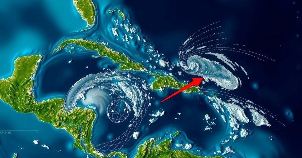
The National Hurricane Center (NHC) has reported an increased likelihood of a tropical depression forming in the Atlantic, primarily tracking a system currently identified as Invest 95L in the northwestern Caribbean Sea. While the system, characterized by a broad area of low pressure, exhibits a growing organization with increased thunderstorms, the NHC indicates it is not expected to impact the United States at this time. This weather system is anticipated to strengthen into a short-lived tropical depression or storm in the next couple of days before it moves inland over Belize and the Yucatan Peninsula of Mexico on Saturday, with a forecasted chance of development at 50 percent over the next 48 hours. Regardless of its potential formation, the NHC warns of heavy rainfall resulting from this system across Central America and southern Mexico throughout the weekend. Additionally, a second system, known as Invest 94L, is being monitored by the NHC. This system is described as a poorly-defined trough of low pressure producing disorganized showers and thunderstorms near the northern Leeward Islands, with a minimal likelihood of further development (only 10 percent chance) due to unfavorable upper-level winds. Currently, it is expected to traverse near or just north of the Virgin Islands and Puerto Rico, and approach Hispaniola and the southeastern Bahamas this weekend. For clarity, the next named storms for the season are expected to be Nadine and Oscar.
The article discusses the current status and forecast of two weather systems in the Atlantic as tracked by the National Hurricane Center (NHC). The focus is on the investigation of potential tropical cyclones and their expected pathways. Understanding these systems is crucial for preparation and response efforts in affected regions, as tropical depressions and storms can bring significant rainfall, leading to flooding and other disruptive weather patterns.
In conclusion, two systems are currently being monitored by the National Hurricane Center, with Invest 95L showing a potential for development into a tropical depression before making landfall in Central America, while Invest 94L is unlikely to intensify due to unfavorable conditions. The public is advised to remain vigilant due to the possibility of heavy rainfall across Central America and southern Mexico, although the United States is not expected to face any immediate impacts from these systems.
Original Source: www.usatoday.com


Post Comment