Weather
90, AFRICA, APPALACHIAN, APPALACHIANS, BOSTON, CENTRAL PARK, FOX, GREAT LAKES, INTERSTATE 90, KENTUCKY, LIFESTYLE, MAINE, MARYLAND, MASSACHUSETTS DEPARTMENT OF TRANSPORTATION, MICHAEL ESTIME, MID, MIDWEST, MISSISSIPPI VALLEY, NEW ENGLAND, NEW HAMPSHIRE, NEW YORK, NEW YORK CITY, NORTH AMERICA, NORTHEAST, OHIO VALLEY, PENNSYLVANIA, PUBLIC WORKS DEPARTMENT, RAIN, SOUTH AFRICA, TRAVEL, UNITED STATES, VERMONT, VIRGINIA, WEATHER, WEATHER FORECAST, WEST VIRGINIA
Marisol Gonzalez
0 Comments
New England Faces Severe Winter Storms with More Expected Soon
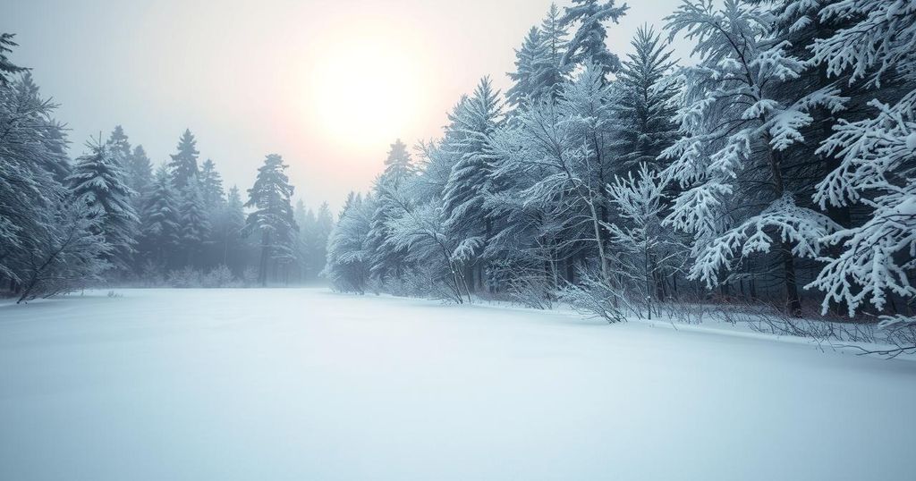
New England faced severe weather as a winter storm swept through, causing a mix of rain, sleet, and snow. While NYC had manageable conditions, areas north recorded substantial snowfall. A second, stronger storm is anticipated this weekend, promising even heavier snowfall.
New England experienced severe winter weather as a significant storm moved through the region Thursday afternoon. This storm was characterized by a mixture of heavy snow, sleet, and freezing rain that initially affected the Midwest and Northeast. As the storm progressed, conditions began to improve in New York City later in the day.
While New York City saw primarily sleet and some snow, areas in New Hampshire, Vermont, and Maine reported substantial snow accumulation, measuring between 3 and 5 inches. Boston’s Public Works Department mobilized over 400 pieces of equipment to address road conditions before the arrival of the worst snowfall.
Icing was particularly severe across the Appalachians, where portions of western Pennsylvania through to northwestern Virginia faced Ice Storm Warnings due to potential ice accumulation of a quarter-inch to half-inch. This severe weather created hazardous conditions prompting many schools in affected areas to close or delay their opening schedule.
In the Ohio Valley and central Appalachians, freezing rain and thunderstorms compounded the challenges presented by the storm, resulting in severe weather and flooding reports from regions like Kentucky and West Virginia. The storm initially began to affect the mid-Mississippi Valley before extending towards the Great Lakes.
As temperatures rose above freezing by Thursday afternoon in cities such as Chicago and Cleveland, the threat of freezing rain diminished. However, the Northeast anticipates another significant storm this weekend, which is forecasted to bring heavier snow than the previous one, impacting similar areas in the process.
A significant winter storm swept across the Northeast region, particularly affecting New England and New York City. The storm caused a wide array of precipitation types including sleet, freezing rain, and snow, leading to hazardous travel conditions and school delays. The National Weather Service recognized the differences in impacts across the region, with some areas experiencing severe icing and flooding due to the unstable weather system.
The recent winter storm has rendered significant snowfall and hazardous conditions across New England and surrounding areas. With a significant storm expected to follow this weekend, the authorities urge the public to prepare for potential severe weather and remain vigilant on the roads. Residents are advised to stay updated with local forecasts and road safety tips to navigate the challenging winter weather ahead.
Original Source: www.foxweather.com


Post Comment