Understanding Australia’s Cyclone Season: An Overview
This article discusses the recent cyclone season in Australia, highlighting severe events like Cyclone Sean and Cyclone Alfred. It covers cyclone formation, naming conventions, and classification systems. Preparedness measures for those in prone areas are also emphasized.
Cyclone season has become a prominent topic of discussion this year, with Australia facing one of its busiest periods in recent memory. For instance, Severe Tropical Cyclone Sean caused remarkable rainfall and storm damage in the Pilbara region last January. Meanwhile, Severe Tropical Cyclone Zelia wreaked havoc across northern WA in February, followed by Tropical Cyclone Alfred impacting Queensland and New South Wales in March. Notably, Ex-Tropical Cyclone Errol, which reached Category 4 while at sea, transitioned into a tropical low as it crossed the Kimberley in April.
In general, Australia sees an average of 11 tropical cyclones annually, with predictions indicating that about four of these might make landfall. The cyclone season typically runs from November to April, primarily occurring in northern Australia. Areas such as the coast north of Exmouth in Western Australia, the Top End, and regions north of Brisbane on the east coast are most frequently affected. Interestingly, cyclones in the southern hemisphere rotate clockwise, whereas in the northern hemisphere they are known as typhoons or hurricanes and spin in the opposite direction.
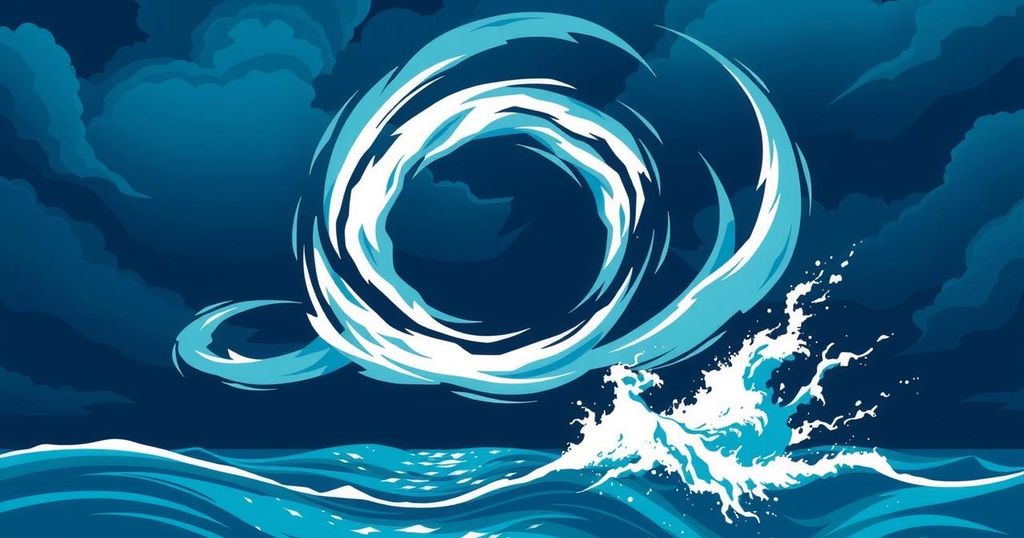
The formation of cyclones requires very specific conditions. The ocean temperature must be at least 26.5°C, which is why they usually develop in tropical waters. When water evaporates, it creates clouds overhead. If air pressure is low enough, these clouds can begin to cluster and spin. For cyclones to maintain their power, the surrounding air must remain humid. To be classified as a cyclone, the wind speeds must exceed 119 kilometers per hour. The eye of the cyclone, which is a calm area within the storm, typically spans about 40 kilometers in diameter, marked by low winds and no rain.
Cyclones can generate powerful swells and surge waters that may endanger coastal areas and vessels. Unfortunately, their strength diminishes when they move ashore, pass over cooler waters, or encounter unfavorable weather conditions. On average, cyclones have a lifespan of about a week.
Naming cyclones follows a specific protocol established by the Bureau of Meteorology, which alternates names between genders and progresses through an alphabetical list. A particularly severe cyclone name may be retired forever if it becomes infamous, thus we won’t see another cyclone named Tracy.
Cyclones are assessed based on their intensity, classified into a scoring system from Category 1 to Category 5. Category 1 cyclones exhibit wind speeds up to 125 kilometers per hour, generating ocean swells up to 1.6 meters, which can inflict damage on trees and farmland. On the opposite end, Category 5 cyclones possess wind speeds exceeding 280 kilometers per hour and can create ocean swells that surpass 5.5 meters, with the potential to flatten buildings. Categories 2, 3, and 4 help to delineate the varying degrees of damage one might expect.
Those living in regions prone to tropical cyclones are urged to be prepared and aware of safety measures. It is advisable to secure windows, fasten loose items, and turn off utilities, as well as to take shelter or evacuate when instructed.
This cyclone season has been particularly active, with multiple severe systems impacting various regions in Australia. Awareness of their characteristics, formation requirements, and classification can significantly aid in preparedness as communities face these powerful weather events. Understanding naming conventions and grading systems also contributes to public knowledge and safety during an unpredictable season.
Original Source: particle.scitech.org.au


Post Comment